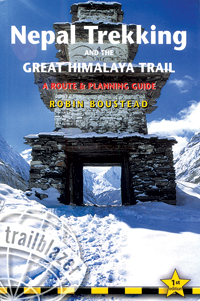
There are several excellent Nepal trekking guidebooks on the market. Here’s one of the newest and best, a specialty guidebook for the trek-of-all-treks — The Great Himalaya Trail, or ‘GHT’. It is written by Robin Boustead, whose name is inextricably connected to exploring and promoting the GHT.
 While the GHT stretches from Tibet and Bhutan, westward across Nepal and northwest India to Pakistan, this book focuses on the approximately 1,700km (1,056 mile) Nepal portion, its’ high trails and subsidiaries, some well worn, and some relatively unknown. The book is a collaboration between Robin Boustead (main author), Bryn Thomas (a section author and editor at the UK’s Trailblazer Publications), and the Kathmandu’s Himalayan Map House.
What makes this guide especially good — besides the all round solid advice and excellent trail descriptions — is the collective disposition of the author(s) and the members of the GHT Alliance network as responsible promoters and supporters. Part 1 reviews the inherent dangers of trekking and encourages wise cultural and ecological stewardship. The ‘Great Himalaya Trail Code’ on page 8 persuades trekkers to pay close attention to issues of Community (sensitivity and consideration of local customs, and benefit to local communities), Environment (tread softly, pack out what you pack in, and conserve natural resources), and Safety (avoid altitude sickness, and be safe and self reliant). Regarding safety, there’s a sidebar on page 89 introducing the Himalayan Rescue Association (HRA) — good to know in case of trouble.
To assist in researching the most appropriate trek for you, there are graphs on seasonal rainfall and temperature data for Namche Bazaar and Kala Patar (Everest area), Kathmandu and Pokhara (central Nepal), Jomsom (Annapurna Conservation Area), and Jumla (Far West). These data and the book’s many maps and synopses of various other aspects of trek are particularly helpful for planning. Informative sidebars focus on ethnic groups and cultural information including festivals and religion, alongside practical advice on crossing high passes. There are notes ranking trail conditions and levels of difficulty and an especially useful chart called the Summary of Trekking Styles, whether you are going independent without a guide, or taking a teahouse trek with a guide, or trekking with a camp crew.
The book also features succinct introductions to Kathmandu (Part 2) and Pokhara (Part 3). After all, you have to begin somewhere, and being well informed on where and how to facilitate the best start to your adventure is highly appreciated. In the Kathmandu section, for example, the book covers arrival (by air or road), orientation, where to stay (Thamel, Freak Street, and other), prices (low end or high), places to eat, nightlife, services, getting around and what to see, and moving on to other destinations in and out of the country.
The Route Guide (Part 4) takes up half of the book, presenting succinct summaries of the main treks in east, central and west Nepal, as well as cultural and social information, along with many variations and subsidiary facts to make your trek all the more interesting or, in some cases, more challenging.
The Appendices include a Bibliography, Glossary, a long list of Nepal Trekking Agencies, and Wind Chill and Heat Index Charts. From the Glossary, for example, did you know that an ablation valley is “an often-shallow valley created by snow and/or ice melt from a glacier,” an amchi is “a traditional doctor in Tibetan medicine,” and amrit is the “mystical water of immortality”? Good to know, and a lot more...
If you are contemplating trekking all or part of the GHT, this is your recommended guidebook.